Rediscovering Royal Drive
From Winchester Street to Broadview and Danforth
Added 2012-05-29, Updated 2012-06-04 with maps
With several hours to kill downtown on a lovely Tuesday afternoon, I decide to visit the terminus of Winchester Street where it meets the valley of the Don.
Here's a screen shot of a Flash Earth satellite view of the general vicinity, with the arrow showing my destination —

Winchester Street heading east from Sumach Street appears to end just past the entrance to the Necropolis cemetery. In fact, it continues into the Riverdale Farm area, but the street itself is closed to the public. Simply enter the farm at that point, and then bear to your left (east). Say hello to the animals if they're out.
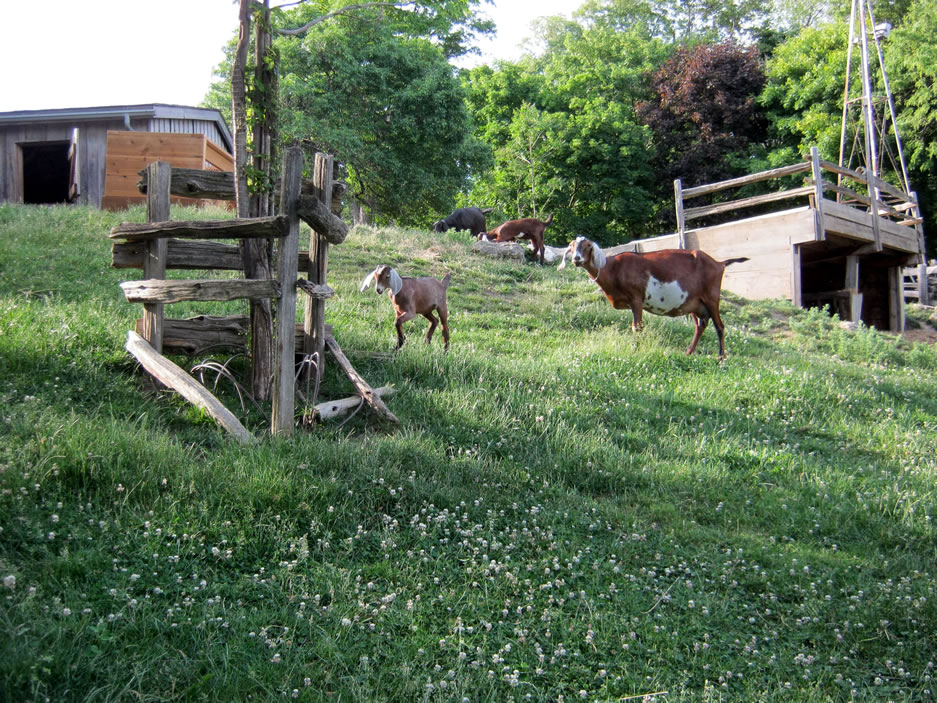
Continue down the road to the east. Here's the view looking back west —

Keep going east until you get to the spot where the road makes a U-turn and heads back southwest, down towards the Riverdale Farm pond —

It is at this point, at this U-turn, where, just a few steps up to the right (north), Winchester Street arrives after coming down the hill beside the Necropolis cemetery, stopping abruptly at this fence —

That's the Bayview Extension in the foreground beyond the fence, and Broadview Avenue across the valley at the top of "Killer Hill" (a popular and insane toboggan hill).
Here's a comparable view of Winchester Street crossing the Don from the Toronto Archives —
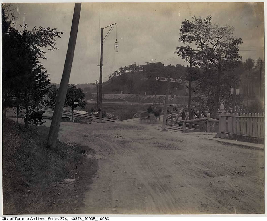
Seen from the other side —

Now from this point, it's best to work your way back out of Riverdale Farm via actual roads and paths. Do not do what I did, and take twenty minutes hacking through thick brush to make a difficult climb over the tall steel fence beside the pedestrian bridge —
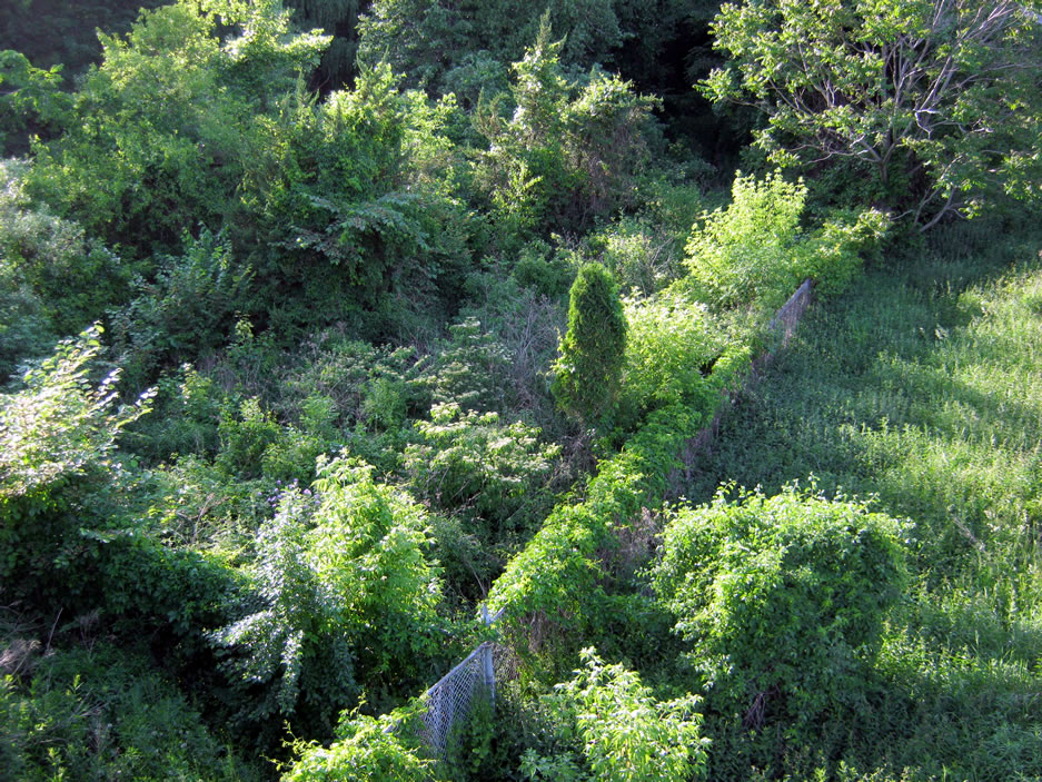
From the pedestrian bridge, you can see three rail lines here heading north. Winchester Street used to cross the Don right at the spot where the rail on the right heads north.

The line going off to the right is the abandoned CP Don Branch line, heading northeast across the valley to run parallel to the DVP and then over the Half-Mile Bridge at the Brick Works.
Here's an excerpt from the Goad's Atlas of 1893 showing Winchester Street's crossing of the Don —
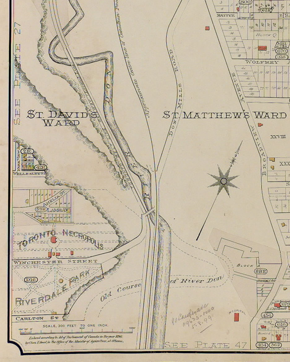
This is a fascinating map for several reasons. The Belt Line Railway, which was in operation from 1892 to 1894, can be seen heading off to the northwest. Winchester Street appears to run alongside the CP Don Branch for a while, before heading to the northeast as "Don Mills Road" (as Broadview Avenue was known north of Danforth). Also, south of Winchester, the former course of the Don River is sketched in, before it was straightened by the Don Improvement Project in the late 1880s. What is now the Riverdale Farm pond is actually an oxbow from the original course of the Don.
By the way, if you're interested in old maps, check out Goad's Atlas of Toronto -- Online!
Anyhow, my original intention was to make my way up the west side of the Don Valley to reach the Brick Works. Finding myself on the pedestrian bridge to Riverdale Park, however, and so it shouldn't be a total loss (a Three Stooges reference), I decide to follow the old route of Winchester Street, the former "Don Mills Road" as it was known on the east side of the river.
More recently, this stretch of road was renamed Royal Drive for the October 1951 visit of Princess Elizabeth to Toronto.
From the Evocative Images of Lost Toronto thread on the UrbanToronto.ca discussion forum, a couple of maps from the Toronto Star of October 5, 1951 —
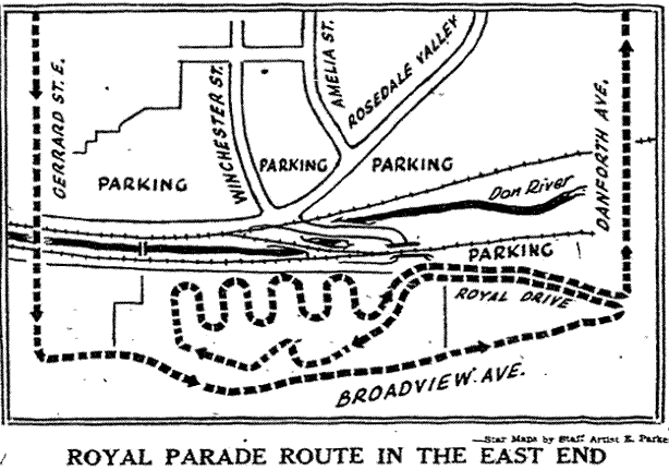
The map shows parking on two sides of Winchester Street, where the pond is, and where the Necropolis is. I doubt very much that those were accurate. The parking to the north of Rosedale Valley Road seems legit.

If you're interested in the royal visit, see Royal Journey, a film by the National Film Board that you can watch online. The visit to Riverdale Park is approximately at the 16-minute mark.
In the northwest corner of Riverdale park, the former Royal Drive starts its gentle climb up the hill —

At this corner is the Riverdale Park East Wetlands, which I shall have to come back to revisit some day —

Further up the road —

And further —
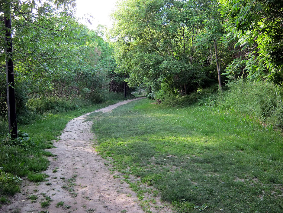
Eventually the road ends at an imposing structure, a footbridge over the ramp from Danforth to the northbound Don Valley Parkway —

The top end of that ramp actually follows the original route of Royal Drive.

Proceeding along the path through the grounds of the City Adult Learning Centre, you eventually come out at Broadview and Danforth where the ramp to the DVP starts —

Again from the Evocative Images of Lost Toronto thread on the UrbanToronto.ca discussion forum, a "then and now" comparison of the end of Winchester Street at Danforth —
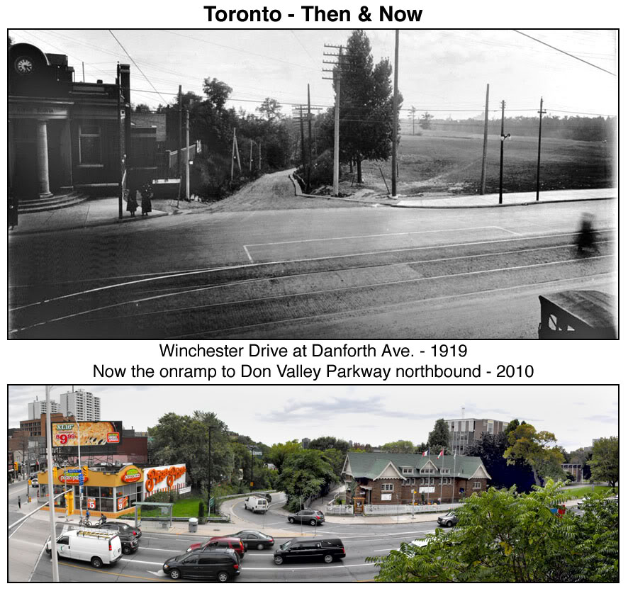
My original intention had been to get to the Spacing Magazine release party at the Brick Works, and as luck would have it, there's a free shuttle bus from Broadview Subway station!
My objective was simply to pick up a copy of the Disaster issue of Spacing Magazine. Spacing is a pretty good magazine, and well worth the $5 price, but this issue is fabulous. I arrived early, had a beer, and left, because I didn't know any of these people and wasn't there to schmooze. I don't schmooze too well.
So out of the Brick Works, and up the hill behind it, to the Governors Bridge Lookout —

In the background above, you can see the north wall of the former quarry excavation, a world-renowned geological site.
From the Lookout, a magnificent view of the valley —

Finally, a view from the top of the north wall itself —
